Chinas and Indias relationship revolves around geopolitical interests, particularly the vital resource of water. Climate change is intensifying the competition for water, including that of the Brahmaputra.
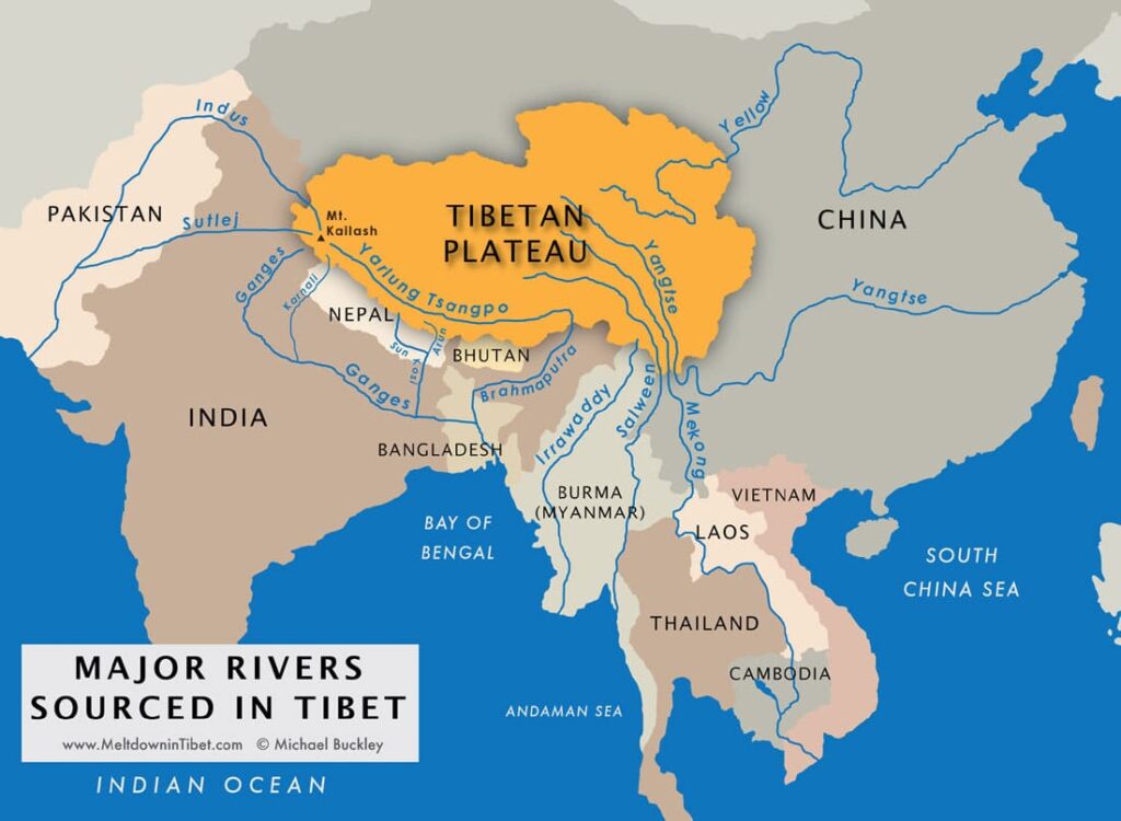
Both countries' freshwater supplies primarily come from the Tibetan Plateau
After the north and south poles, the world’s largest freshwater reserve is the Tibetan Plateau. The plateau feeds rivers such as the Yellow River, Yangtze, Mekong, Indus, and Brahmaputra.
- 70% of India’s freshwater comes from rivers and river systems like the Ganges, Yamuna, and Brahmaputra, while the remaining 30% comes from groundwater and rainfall.
- For China, the figure is around 60-70%. The Yangtze River alone accounts for nearly 35% of China’s freshwater. Therefore, the river is crucial for China’s economy and the survival of its population.
The border between China and India, Nepal, and Bhutan was established in 1947 when India gained independence. However, at that time, China was in a civil war. Consequently, China’s first major action after its formation in October 1949 was to invade Tibet in 1950. This invasion was partly motivated by the fear that India might have done the same.
China is building a significant part of its climate transition around hydropower from Tibet
Today, 15-18% of China’s electricity is generated from hydropower plants. The water for these comes predominantly from the Tibetan Plateau. Hydropower is central to China’s plan for carbon neutrality by 2060, and therefore many new dams are on the way. A large portion of these will be in Tibet. This will affect the Yarlung Zangbo River, known as the Brahmaputra in India.
Over the past 10 years, China has already built 4 large dams on the river and plans to build at least 8 more within the next 10 years. Their total capacity will be 60 GW. Additionally, China plans to build the world’s largest dam, with a capacity of 60-80 GW, near “the great bend” (Yarlung Zangbo). Here, there is a total drop of about 2000 meters over a distance of less than 70 km.
Eastern India and Bangladesh depend on the Brahmaputra River
This raises concerns for India. Firstly, water from the Brahmaputra is vital for agriculture and the population in India’s northeastern states, Assam and Arunachal Pradesh. Dams could therefore threaten the livelihood of these states. They experienced this in both 2012 and most recently in 2023, when elevated water levels in the river led to severe flooding and many deaths in both India and Bangladesh. Since 2017, China has stopped sharing information with neighboring countries about water storage in the Tibetan Plateau.
Most recently, this has led India to consider constructing a 10 GW dam on one of the Brahmaputra’s tributaries. This dam would serve, among other things, as a pressure release to regulate the flow of the Brahmaputra.
Both the Chinese and Indian sides of the border are also geologically vulnerable due to their location between the Eurasian and Indian plates. Earthquakes and dam failures could therefore be particularly catastrophic.
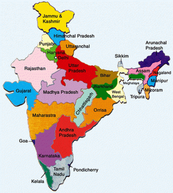
Finally, the 7 northeastern states are in a militarily strategic vulnerable position for India. They are all connected to India via the narrow 25 km Siliguri land corridor (known as the “chicken’s neck”). This area experiences regular confrontations between the Indian and Chinese armies. Additionally, the area was notably the battleground in the Sino-Indian War of 1962. India therefore closely monitors all construction and troop movements on the Chinese side of the border via satellite. It is a tense area.
Overall, China has similar potential geopolitical power over India as Ethiopia does over Sudan and Egypt (the Nile). The “battle for water from Tibet” will escalate as climate change leads to decreasing precipitation (especially snow) on the Tibetan Plateau. Both China and India are heavily dependent on water and energy from this region.