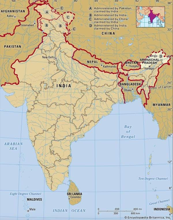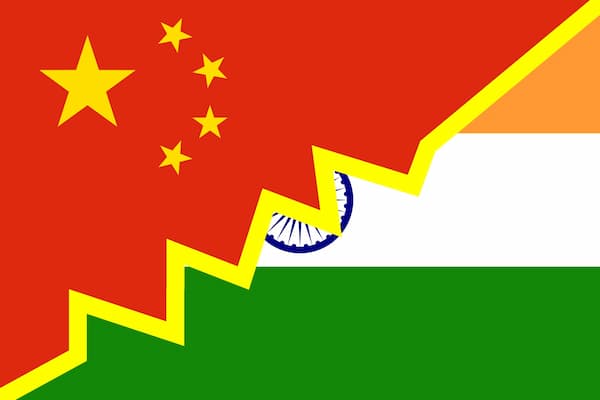
Indias and Chinas relation became even more tense when China's new official map from 2023 marked Arunachal Pradesh as Chinese.
New Maps from China Show Old Territorial Claims on Arunachal Pradesh
In August 2023, China released new official "standard maps." Among the changes, China had now marked the province of Arunachal Pradesh, bordering Tibet, as Chinese territory, under the name Zangnan (South Tibet).
The revised maps were condemned by India, and in March 2024, the USA followed suit, rejecting "Beijing’s unilateral attempts to increase its territorial claims." This triggered a sharp response from China against the USA for interfering in the border disputes: "China strongly deplores and firmly opposes this. Zangnan has always been China’s territory, a basic fact that is undeniable."
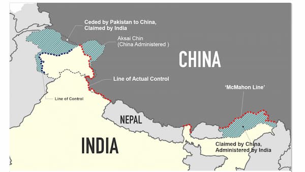
The current border (Line of Actual Control) between Arunachal Pradesh and Tibet was established after negotiations led by British official Henry McMahon in 1914. Tibet and Britain signed the convention, but China never recognized the agreement. It was yet another of the borders imposed on China during the "Century of Humiliation" (1839 to 1949).
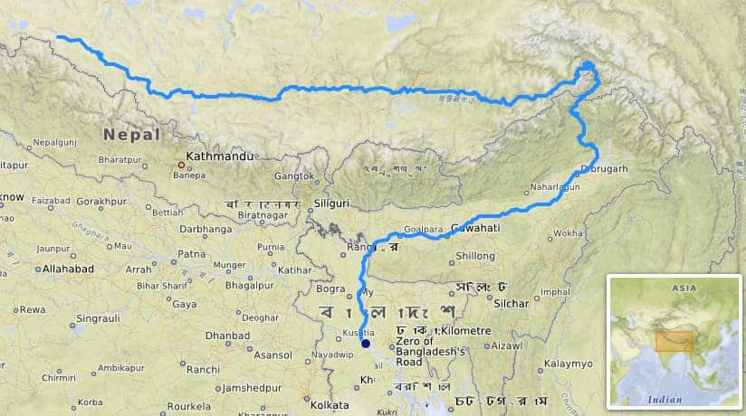
Arunachal Pradesh is one and a half times the size of Denmark and has 1.4 million inhabitants. The area's strategic value comes partly from important mineral deposits but primarily from the fact that this is where the Brahmaputra (Yarlung Tsangpo) River gathers 35% of its water (50% is collected in Tibet). The Brahmaputra is vital for eastern India and Bangladesh.
Arunachal Pradesh is Strategically and Symbolically Important for Both Countries
India considers the region to be of military strategic importance and invests significant resources in manning and fortifying it. China is similarly building up on its side, raising concerns in India.
The two parties currently have an agreement that their soldiers remain unarmed. However, in 2020, 30 Indian soldiers and at least 7 Chinese soldiers died after several skirmishes between the forces. The region was also the main stage for the Sino-Indian war in October 1962. The war resulted in over 2,000 casualties on both sides and was never officially concluded. In November 1962, China instead declared a unilateral ceasefire and then withdrew its forces north of the McMahon Line.
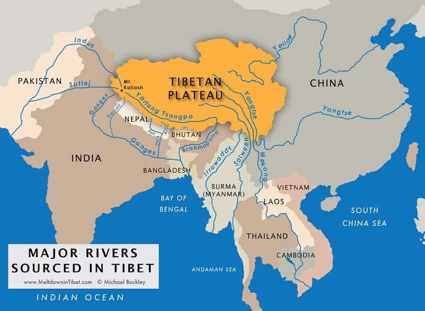
Yarlung Tsangpo originates in Tibet and is the largest of Tibet's rivers. But it is also the river whose hydropower potential is still the least exploited. So far, China has "only" built four hydropower plants with a combined capacity of over 2 GW. In addition, China plans to construct three more hydropower plants. These power plants significantly affect the water levels in India’s Assam province but even more so in Bangladesh. This will increase with climate change, which is expected to reduce glacial meltwater by one-third by 2050. As a result, water volumes will decrease while demand for water will rise due to growing populations in Southeast Asia. According to the UN, water scarcity will affect 1.8 billion people by 2025, most of them in Asia.
Water Brings Life and Power
Bangladesh is at the greatest overall risk, as the southern part of the country is a vast river delta fed by the Brahmaputra and Ganges rivers. The situation is worsened by India's own large-scale hydropower ambitions. Bangladesh is already experiencing problems with increasing salinity in its agricultural water, as the water levels in the river delta have dropped so much that seawater is intruding.
Through the Belt and Road Initiative, China has provided significant development loans to Bangladesh. This is likely a major reason why Bangladesh's protests over upstream dams are almost exclusively directed at India.
Thus, China holds potential geopolitical power over India, similar to Ethiopia's influence over Sudan and Egypt regarding the Nile.
There are no globally binding agreements on water supplies, such as those concerning "trans-boundary rivers."
The UN’s convention "on the Law of the Non-Navigational Uses of International Watercourses" offers some principles. However, the principles are often ambiguous and depend on interpretation.
Moreover, forums such as the World Water Forum regularly try to foster dialogues to promote fair water management between states and sometimes seek to resolve conflicts over water resources.
It is fundamentally difficult to control or verify what happens in a neighboring country. When survival is threatened, conventions and agreements often become of secondary importance.